Austria

Европа

Австрийская Республика

Западная Европа
83858
km2
2км+1км+250м *.jnx
Бумажные военные карты Генерального штаба
1: 100 000  80х-90х годов
Бумажные военные карты Генерального штаба
1: 50 000  80х-90х годов
Современные военные карты ГосГисЦентр
1: 25 000  2010х годов выпуска.

We've prepared a map of every hill and clearing for your next trip.

The map contains detailed topographical data, including: landforms, elevations, roads and trails, rivers, lakes and geographic points.
Accurate mapping of cards. The position is on the road, not 100 meters from it.
Electric transmission lines are drawn in detail, poles, deforestation, bushes and gardens under power lines are marked
The boundaries of the blocks and numbers are indicated, quarterly clearings, cutting along them,
При заказе других стран так же используется карты Генерального штаба СССР, местные военные карты и материал проекта OSM. 100% покрытие по всей планете. Максимальная детализация.
Исландия, окрестности Рейкьявика
The set includes 3 raster layers, arranged by scale:

1:25 000

newest tOPO maps

1 cm = 250m
250 meters
The cartographic product of the State Gis Center is the most detailed topographic military maps of the Russian Federation.
The margins of the sheets are trimmed and the edges are glued together seamlessly.
Brightness and contrast are manually increased for better readability in the field.

military maps 80-90s

General Staff 1: 100 000

1 cm = 1 km
Kilometers maps
Detailed maps of the area, available both for the nearest forest park and for the Amazonian jungle.
As a result of the Cold War, communism did not win throughout the entire planet. But the far-reaching plans of the USSR left detailed cartography covering the planet. With the collapse of the Union, the maps of the “general staff” became public knowledge.
These maps still have no modern analogues in difficult-to-reach areas.

military maps 80-90s

General Staff 1: 200,000

1 cm = 2 km
2-kilometer routes
A vector img background is applied.  Modern roads with well-established clearings and populated areas.  The map is scaled for easy searching at a distance.  There is address search and routing using vector material.
Sat *.jnx
Satellite imagery is an up-to-date map of the area from this year.

Only on satellite imagery will you see the exact shape of each clearing and individual trees, the contour of the reservoir with 100% coincidence in coordinates and the new river bed.

We have prepared modern satellite maps for use on Garmin and Lowrance navigators and chart plotters, as a more detailed alternative to proprietary services.
We present preloaded satellite images at 1:10000 scale.  Throughout the entire region (subject of the Russian Federation).

When preparing maps, we are not limited by the capabilities of the garmin service, in terms of file size and territory. Thanks to this, the satellite map of the Kamchatka region occupies 8GB and has 100% coverage over the entire territory with a detail of 120m.  at 1 cm.
Garmin Birdseye  - satellite map download service for garmin.   The service operates on a subscription basis.   Subscription fee is $30 per year.

You can upload pictures up to 100MB. In this volume it is possible to install maps with a radius of up to 25 km, with minimal detail.  Uploading images of an entire region is not possible. Before each new route, preliminary loading of a separate area of ​​maps from a PC is required.
Garmin's satellite image provider is Microsoft's Bing service. Bing has excellent coverage throughout the US and Europe.

But there are territorial gaps in the Russian Federation. When preparing maps, satellite imagery of resources is used: Yandex, Esri, Google, Bing.  Material Combines for 100% coverage in a given area.
A relief and a vector map with roads, clearings, rivers, populated and useful points are superimposed. Can be installed as a main map or as an addition to general staff or depth maps.
3in1 *.jnx
Routing Vector Map

ExploreAustria with Garmin Maps

Austria, a country nestled in the heart of Europe, is renowned for itsstunning Alpine landscapes, historic cities, and charming villages. Whetheryou're planning to hike the Austrian Alps, explore Vienna's imperialarchitecture, or simply enjoy the beautiful countryside, Garmin maps are yourideal companions for navigation.

Garmin Maps: Your Gateway toAustrian Adventure

Free Garmin Maps for Austria

Say goodbye to the hassle of purchasing physical maps or relying on aninternet connection with Garmin maps. You can easily download comprehensivemaps for Austria onto your Garmin device for free, ensuring that you havedetailed navigation data available wherever your Austrian adventures take you.

Navigate Austria with GarminGPSMAP Devices

Garmin offers a range of GPSMAP devices, including the popular GPSMAP 64series and the more advanced GPSMAP 66 series. These devices provide precisenavigation and come preloaded with topographic maps, making them perfect foroutdoor enthusiasts, hikers, and nature lovers.

Seamless SmartwatchIntegration

For those who prefer the convenience of a smartwatch, Garmin mapsseamlessly integrate with Garmin smartwatches such as the Fenix 6 and Fenix 7series. Whether you're exploring the charming streets of Salzburg or skiing inthe Austrian Alps, your Garmin smartwatch will keep you on track.

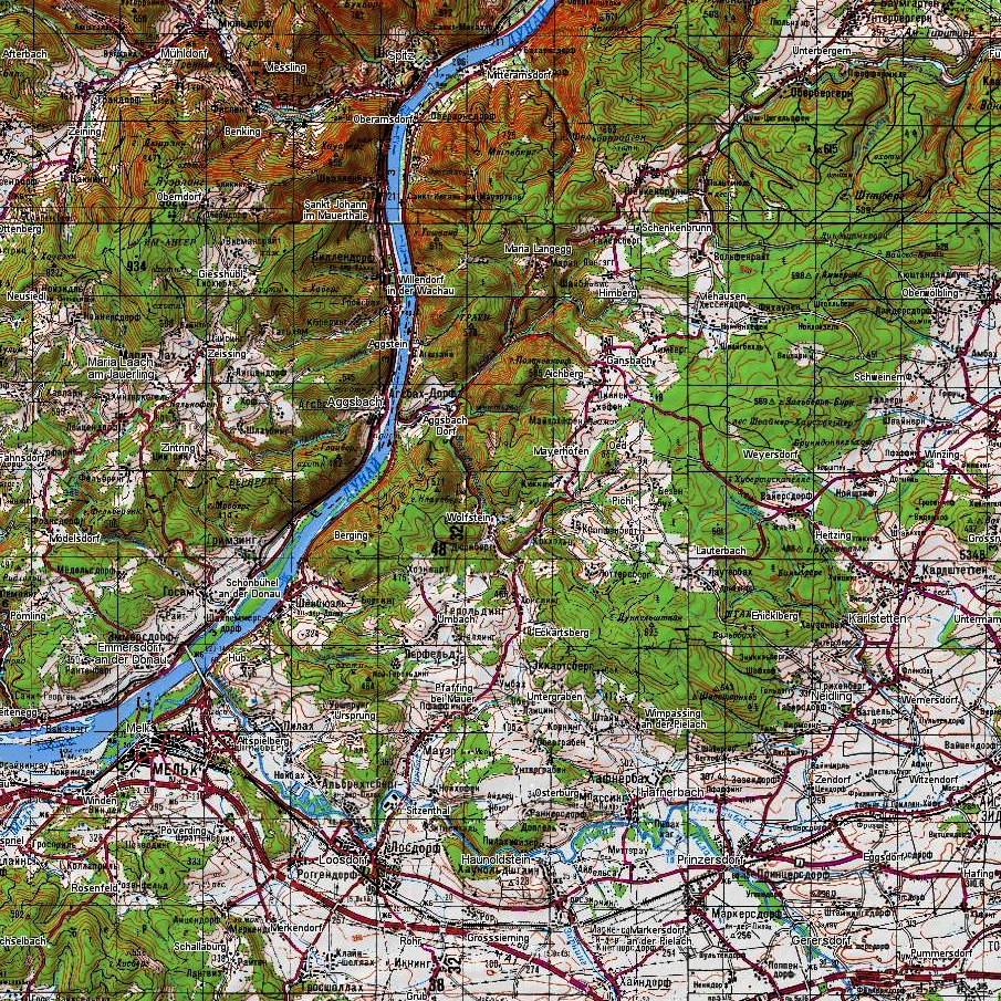
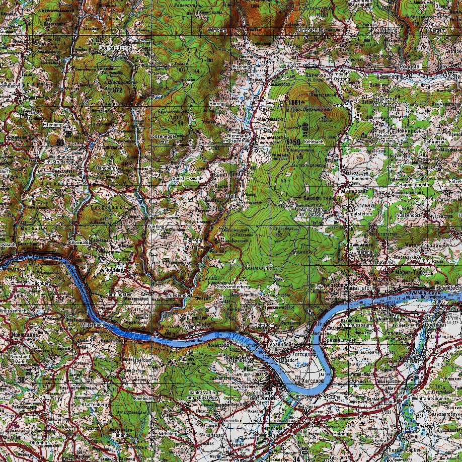
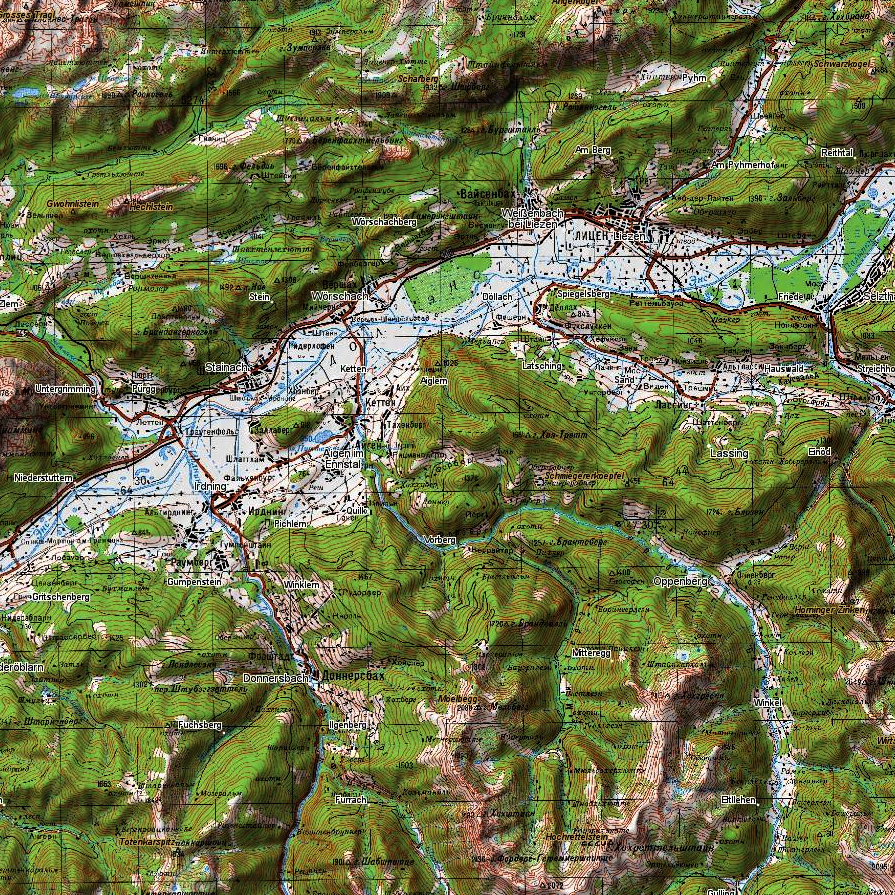
Detailed Topographic Maps forAlpine Adventures

Austria's breathtaking Alpine regions demand detailed maps, and Garmin'stopographic maps offer just that. Whether you're trekking through the Austrianmountains or embarking on a cross-country skiing expedition, these maps provideessential elevation data for a safe and enjoyable journey.

Garmin Maps for All YourAustrian Adventures

Garmin maps cater to a wide range of devices, ensuring that you have accessto high-quality maps regardless of your chosen mode of exploration. Fromhandheld GPS units for hikers to cycling computers like the Garmin Edge seriesfor cyclists, Garmin has you covered.

Military-Grade Precision

For those who require military-grade precision, Garmin's tactical watches,such as the Tactix series, feature maps tailored for tactical use. Whetheryou're in the armed forces or need the utmost accuracy for your adventures,Garmin delivers.

Start Your Austrian Adventurewith Garmin Maps

Getting started with Garmin maps is straightforward. Download the maps youneed, transfer them to your Garmin device, and you're ready to embark on yourAustrian journey. Garmin's user-friendly interfaces make it easy to plan routes,mark waypoints, and document your experiences.

In Conclusion

Austria's diverse landscapes, rich history, and cultural treasures make itan enchanting destination for travelers. Garmin maps provide the essentialtools for exploring this beautiful country with confidence. Download Garminmaps for Austria and set out on your next adventure!

Road network and settlements
  • Address search
Route planning
Adress  Search
Satellite imagery is an up-to-date map of the area from this year.  

Only on satellite imagery will you see the exact shape of each clearing and individual trees, the contour of the reservoir with 100% coincidence in coordinates and the new river bed.

We have prepared modern satellite maps for use on Garmin and Lowrance navigators and chart plotters, as a more detailed alternative to proprietary services.
We present preloaded satellite images at 1:10000 scale.  Throughout the entire region (subject of the Russian Federation).

When preparing maps, we are not limited by the capabilities of the garmin service, in terms of file size and territory. Thanks to this, the satellite map of the Kamchatka region occupies 8GB and has 100% coverage over the entire territory with a detail of 120m.  at 1 cm.
Garmin Birdseye - satellite map download service for garmin.   The service operates on a subscription basis.   Subscription fee is $30 per year.  

You can upload pictures up to 100MB. In this volume it is possible to install maps with a radius of up to 25 km, with minimal detail.  Uploading images of an entire region is not possible. Before each new route, preliminary loading of a separate area of   maps from a PC is required.
Garmin's satellite image provider is Microsoft's Bing service. Bing has excellent coverage throughout the US and Europe.

But there are territorial gaps in the Russian Federation. When preparing maps, satellite imagery of resources is used: Yandex, Esri, Google, Bing.  Material Combines for 100% coverage in a given area.

A relief and a vector map with roads, clearings, rivers, populated and useful points are superimposed. Can be installed as a main map or as an addition to general staff or depth maps.
Бумажные военные карты Генерального штаба
1: 100 000  80х-90х годов
Бумажные военные карты Генерального штаба
1: 50 000  80х-90х годов
Современные военные карты ГосГисЦентр
1: 25 000  2010х годов выпуска.

We've prepared a map of every hill and clearing for your next trip.  

The map contains detailed topographical data, including: landforms, elevations, roads and trails, rivers, lakes and geographic points.
Accurate mapping of cards. The position is on the road, not 100 meters from it.
Electric transmission lines are drawn in detail, poles, deforestation, bushes and gardens under power lines are marked
The boundaries of the blocks and numbers are indicated, quarterly clearings, cutting along them,
При заказе других стран так же используется карты Генерального штаба СССР, местные военные карты и материал проекта OSM. 100% покрытие по всей планете. Максимальная детализация.
Исландия, окрестности Рейкьявика
The set includes 3 raster layers, arranged by scale:  

1:25 000

newest military maps

1 cm = 250m  
250 meters  
The cartographic product of the State Gis Center is the most detailed topographic military maps of the Russian Federation.
The margins of the sheets are trimmed and the edges are glued together seamlessly.
Brightness and contrast are manually increased for better readability in the field.

military maps 80-90s

ussr 1: 100 000

1 cm = 1 km
Detailed maps of the area, available both for the nearest forest park and for the Amazonian jungle.
As a result of the Cold War, communism did not win throughout the entire planet. But the far-reaching plans of the USSR left detailed cartography covering the planet. With the collapse of the Union, the maps of the “general staff” became public knowledge.
These maps still have no modern analogues in difficult-to-reach areas.

military maps 80-90s

ussr 1: 200,000

1 cm = 2 km
A vector img background is applied.  Modern roads with well-established clearings and populated areas.  The map is scaled for easy searching at a distance.  There is address search and routing using vector material.

Vector & All Rastr Layers

Бумажные военные карты Генерального штаба
1: 100 000  80х-90х годов
Бумажные военные карты Генерального штаба
1: 50 000  80х-90х годов
Современные военные карты ГосГисЦентр
1: 25 000  2010х годов выпуска.

We've prepared a map of every hill and clearing for your next trip.  

The map contains detailed topographical data, including: landforms, elevations, roads and trails, rivers, lakes and geographic points.
Accurate mapping of cards. The position is on the road, not 100 meters from it.
Electric transmission lines are drawn in detail, poles, deforestation, bushes and gardens under power lines are marked
The boundaries of the blocks and numbers are indicated, quarterly clearings, cutting along them,
При заказе других стран так же используется карты Генерального штаба СССР, местные военные карты и материал проекта OSM. 100% покрытие по всей планете. Максимальная детализация.
Исландия, окрестности Рейкьявика
The set includes 3 raster layers, arranged by scale:  

1:25 000

newest military maps

1 cm = 250m  
250 meters  
The cartographic product of the State Gis Center is the most detailed topographic military maps of the Russian Federation.
The margins of the sheets are trimmed and the edges are glued together seamlessly.
Brightness and contrast are manually increased for better readability in the field.

military maps 80-90s

ussr 1: 100 000

1 cm = 1 km
Detailed maps of the area, available both for the nearest forest park and for the Amazonian jungle.
As a result of the Cold War, communism did not win throughout the entire planet. But the far-reaching plans of the USSR left detailed cartography covering the planet. With the collapse of the Union, the maps of the “general staff” became public knowledge.
These maps still have no modern analogues in difficult-to-reach areas.

military maps 80-90s

ussr 1: 200,000

1 cm = 2 km
A vector img background is applied.  Modern roads with well-established clearings and populated areas.  The map is scaled for easy searching at a distance.  There is address search and routing using vector material.
Satellite imagery is an up-to-date map of the area from this year.  

Only on satellite imagery will you see the exact shape of each clearing and individual trees, the contour of the reservoir with 100% coincidence in coordinates and the new river bed.

We have prepared modern satellite maps for use on Garmin and Lowrance navigators and chart plotters, as a more detailed alternative to proprietary services.
We present preloaded satellite images at 1:10000 scale.  Throughout the entire region (subject of the Russian Federation).

When preparing maps, we are not limited by the capabilities of the garmin service, in terms of file size and territory. Thanks to this, the satellite map of the Kamchatka region occupies 8GB and has 100% coverage over the entire territory with a detail of 120m.  at 1 cm.
Garmin Birdseye - satellite map download service for garmin.   The service operates on a subscription basis.   Subscription fee is $30 per year.  

You can upload pictures up to 100MB. In this volume it is possible to install maps with a radius of up to 25 km, with minimal detail.  Uploading images of an entire region is not possible. Before each new route, preliminary loading of a separate area of   maps from a PC is required.
Garmin's satellite image provider is Microsoft's Bing service. Bing has excellent coverage throughout the US and Europe.

But there are territorial gaps in the Russian Federation. When preparing maps, satellite imagery of resources is used: Yandex, Esri, Google, Bing.  Material Combines for 100% coverage in a given area.

A relief and a vector map with roads, clearings, rivers, populated and useful points are superimposed. Can be installed as a main map or as an addition to general staff or depth maps.