Malta

Европа

2км+1км+250м *.jnx
Бумажные военные карты Генерального штаба
1: 100 000  80х-90х годов
Бумажные военные карты Генерального штаба
1: 50 000  80х-90х годов
Современные военные карты ГосГисЦентр
1: 25 000  2010х годов выпуска.

We've prepared a map of every hill and clearing for your next trip.

The map contains detailed topographical data, including: landforms, elevations, roads and trails, rivers, lakes and geographic points.
Accurate mapping of cards. The position is on the road, not 100 meters from it.
Electric transmission lines are drawn in detail, poles, deforestation, bushes and gardens under power lines are marked
The boundaries of the blocks and numbers are indicated, quarterly clearings, cutting along them,
При заказе других стран так же используется карты Генерального штаба СССР, местные военные карты и материал проекта OSM. 100% покрытие по всей планете. Максимальная детализация.
Исландия, окрестности Рейкьявика
The set includes 3 raster layers, arranged by scale:

1:25 000

newest tOPO maps

1 cm = 250m
250 meters
The cartographic product of the State Gis Center is the most detailed topographic military maps of the Russian Federation.
The margins of the sheets are trimmed and the edges are glued together seamlessly.
Brightness and contrast are manually increased for better readability in the field.

military maps 80-90s

General Staff 1: 100 000

1 cm = 1 km
Kilometers maps
Detailed maps of the area, available both for the nearest forest park and for the Amazonian jungle.
As a result of the Cold War, communism did not win throughout the entire planet. But the far-reaching plans of the USSR left detailed cartography covering the planet. With the collapse of the Union, the maps of the “general staff” became public knowledge.
These maps still have no modern analogues in difficult-to-reach areas.

military maps 80-90s

General Staff 1: 200,000

1 cm = 2 km
2-kilometer routes
A vector img background is applied.  Modern roads with well-established clearings and populated areas.  The map is scaled for easy searching at a distance.  There is address search and routing using vector material.
Sat *.jnx
Satellite imagery is an up-to-date map of the area from this year.

Only on satellite imagery will you see the exact shape of each clearing and individual trees, the contour of the reservoir with 100% coincidence in coordinates and the new river bed.

We have prepared modern satellite maps for use on Garmin and Lowrance navigators and chart plotters, as a more detailed alternative to proprietary services.
We present preloaded satellite images at 1:10000 scale.  Throughout the entire region (subject of the Russian Federation).

When preparing maps, we are not limited by the capabilities of the garmin service, in terms of file size and territory. Thanks to this, the satellite map of the Kamchatka region occupies 8GB and has 100% coverage over the entire territory with a detail of 120m.  at 1 cm.
Garmin Birdseye  - satellite map download service for garmin.   The service operates on a subscription basis.   Subscription fee is $30 per year.

You can upload pictures up to 100MB. In this volume it is possible to install maps with a radius of up to 25 km, with minimal detail.  Uploading images of an entire region is not possible. Before each new route, preliminary loading of a separate area of ​​maps from a PC is required.
Garmin's satellite image provider is Microsoft's Bing service. Bing has excellent coverage throughout the US and Europe.

But there are territorial gaps in the Russian Federation. When preparing maps, satellite imagery of resources is used: Yandex, Esri, Google, Bing.  Material Combines for 100% coverage in a given area.
A relief and a vector map with roads, clearings, rivers, populated and useful points are superimposed. Can be installed as a main map or as an addition to general staff or depth maps.
3in1 *.jnx
Routing Vector Map

Discovering Malta with Garmin Maps and GPS Devices

Malta, a small archipelago in the Mediterranean Sea, offers travelers a rich blend of history, culture, and stunning landscapes. Whether you're exploring the ancient streets of Valletta, diving into crystal-clear waters, or visiting historic sites like the Ħal Saflieni Hypogeum, efficient navigation is crucial for making the most of your Maltese adventure. Garmin maps, paired with advanced GPS devices, provide the ideal solution for exploring the beauty of this Mediterranean gem.

Comprehensive Garmin Maps for Malta

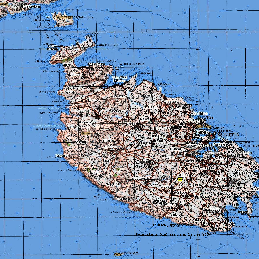
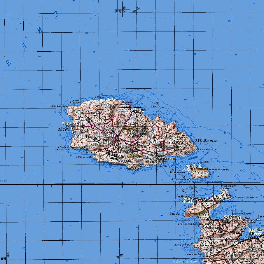
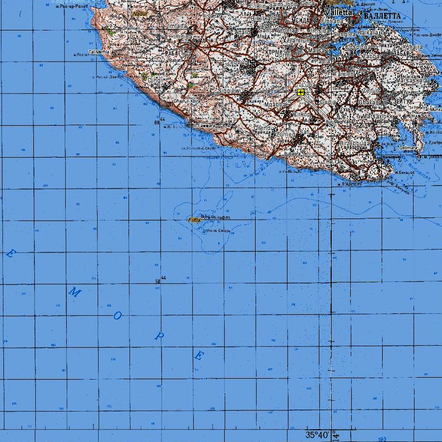
Navigating Malta is made effortless with Garmin GPS devices, offering a variety of map layers, including the highly detailed GPSMAP 276cx. These maps provide extensive coverage and invaluable insights into Malta's unique geography. The GPSMAP 66, known for its precision, ensures you can confidently explore not only the historic streets of Valletta but also the rugged coastlines, hidden coves, and archaeological wonders.

Efficient Urban Exploration with GPSMAP 65

Valletta, the capital of Malta, is renowned for its UNESCO-listed historic city center and stunning architecture. Garmin's GPSMAP 65 simplifies your navigation in this city, helping you discover landmarks like St. John's Co-Cathedral, the Grand Master's Palace, or the bustling markets.

Embracing Nature's Beauty with Oregon 700 and Montana 700

Malta offers diverse natural beauty, from the pristine beaches of Golden Bay to the dramatic cliffs of Dingli. Whether you're hiking in the countryside, diving in the Blue Grotto, or exploring the ancient temples of Ħaġar Qim, Garmin's Oregon 700 and Montana 700 are reliable companions for these outdoor adventures, providing precise navigation across various terrains.

Balancing Content and Keywords

As you prepare for your Maltese adventure, having Garmin maps on your side ensures you have not only essential navigation tools but also peace of mind. Whether you're savoring Maltese cuisine, diving into history, or enjoying the vibrant local culture, Garmin's navigation solutions ensure you can confidently explore all that this Mediterranean jewel has to offer.

Conclusion: Navigating Malta's Treasures

In conclusion, Malta's allure lies in its historical sites, natural beauty, and unique culture, and Garmin maps and GPS devices ensure you can navigate it all with ease. From ancient temples to stunning beaches, these tools offer reliable navigation for a memorable Maltese adventure. Plan your journey to Malta, download Garmin maps, and embark on an unforgettable exploration in this Mediterranean paradise, where history and beauty converge at every turn.

Road network and settlements
  • Address search
Route planning
Adress  Search
Satellite imagery is an up-to-date map of the area from this year.  

Only on satellite imagery will you see the exact shape of each clearing and individual trees, the contour of the reservoir with 100% coincidence in coordinates and the new river bed.

We have prepared modern satellite maps for use on Garmin and Lowrance navigators and chart plotters, as a more detailed alternative to proprietary services.
We present preloaded satellite images at 1:10000 scale.  Throughout the entire region (subject of the Russian Federation).

When preparing maps, we are not limited by the capabilities of the garmin service, in terms of file size and territory. Thanks to this, the satellite map of the Kamchatka region occupies 8GB and has 100% coverage over the entire territory with a detail of 120m.  at 1 cm.
Garmin Birdseye - satellite map download service for garmin.   The service operates on a subscription basis.   Subscription fee is $30 per year.  

You can upload pictures up to 100MB. In this volume it is possible to install maps with a radius of up to 25 km, with minimal detail.  Uploading images of an entire region is not possible. Before each new route, preliminary loading of a separate area of   maps from a PC is required.
Garmin's satellite image provider is Microsoft's Bing service. Bing has excellent coverage throughout the US and Europe.

But there are territorial gaps in the Russian Federation. When preparing maps, satellite imagery of resources is used: Yandex, Esri, Google, Bing.  Material Combines for 100% coverage in a given area.

A relief and a vector map with roads, clearings, rivers, populated and useful points are superimposed. Can be installed as a main map or as an addition to general staff or depth maps.
Бумажные военные карты Генерального штаба
1: 100 000  80х-90х годов
Бумажные военные карты Генерального штаба
1: 50 000  80х-90х годов
Современные военные карты ГосГисЦентр
1: 25 000  2010х годов выпуска.

We've prepared a map of every hill and clearing for your next trip.  

The map contains detailed topographical data, including: landforms, elevations, roads and trails, rivers, lakes and geographic points.
Accurate mapping of cards. The position is on the road, not 100 meters from it.
Electric transmission lines are drawn in detail, poles, deforestation, bushes and gardens under power lines are marked
The boundaries of the blocks and numbers are indicated, quarterly clearings, cutting along them,
При заказе других стран так же используется карты Генерального штаба СССР, местные военные карты и материал проекта OSM. 100% покрытие по всей планете. Максимальная детализация.
Исландия, окрестности Рейкьявика
The set includes 3 raster layers, arranged by scale:  

1:25 000

newest military maps

1 cm = 250m  
250 meters  
The cartographic product of the State Gis Center is the most detailed topographic military maps of the Russian Federation.
The margins of the sheets are trimmed and the edges are glued together seamlessly.
Brightness and contrast are manually increased for better readability in the field.

military maps 80-90s

ussr 1: 100 000

1 cm = 1 km
Detailed maps of the area, available both for the nearest forest park and for the Amazonian jungle.
As a result of the Cold War, communism did not win throughout the entire planet. But the far-reaching plans of the USSR left detailed cartography covering the planet. With the collapse of the Union, the maps of the “general staff” became public knowledge.
These maps still have no modern analogues in difficult-to-reach areas.

military maps 80-90s

ussr 1: 200,000

1 cm = 2 km
A vector img background is applied.  Modern roads with well-established clearings and populated areas.  The map is scaled for easy searching at a distance.  There is address search and routing using vector material.

Vector & All Rastr Layers

Бумажные военные карты Генерального штаба
1: 100 000  80х-90х годов
Бумажные военные карты Генерального штаба
1: 50 000  80х-90х годов
Современные военные карты ГосГисЦентр
1: 25 000  2010х годов выпуска.

We've prepared a map of every hill and clearing for your next trip.  

The map contains detailed topographical data, including: landforms, elevations, roads and trails, rivers, lakes and geographic points.
Accurate mapping of cards. The position is on the road, not 100 meters from it.
Electric transmission lines are drawn in detail, poles, deforestation, bushes and gardens under power lines are marked
The boundaries of the blocks and numbers are indicated, quarterly clearings, cutting along them,
При заказе других стран так же используется карты Генерального штаба СССР, местные военные карты и материал проекта OSM. 100% покрытие по всей планете. Максимальная детализация.
Исландия, окрестности Рейкьявика
The set includes 3 raster layers, arranged by scale:  

1:25 000

newest military maps

1 cm = 250m  
250 meters  
The cartographic product of the State Gis Center is the most detailed topographic military maps of the Russian Federation.
The margins of the sheets are trimmed and the edges are glued together seamlessly.
Brightness and contrast are manually increased for better readability in the field.

military maps 80-90s

ussr 1: 100 000

1 cm = 1 km
Detailed maps of the area, available both for the nearest forest park and for the Amazonian jungle.
As a result of the Cold War, communism did not win throughout the entire planet. But the far-reaching plans of the USSR left detailed cartography covering the planet. With the collapse of the Union, the maps of the “general staff” became public knowledge.
These maps still have no modern analogues in difficult-to-reach areas.

military maps 80-90s

ussr 1: 200,000

1 cm = 2 km
A vector img background is applied.  Modern roads with well-established clearings and populated areas.  The map is scaled for easy searching at a distance.  There is address search and routing using vector material.
Satellite imagery is an up-to-date map of the area from this year.  

Only on satellite imagery will you see the exact shape of each clearing and individual trees, the contour of the reservoir with 100% coincidence in coordinates and the new river bed.

We have prepared modern satellite maps for use on Garmin and Lowrance navigators and chart plotters, as a more detailed alternative to proprietary services.
We present preloaded satellite images at 1:10000 scale.  Throughout the entire region (subject of the Russian Federation).

When preparing maps, we are not limited by the capabilities of the garmin service, in terms of file size and territory. Thanks to this, the satellite map of the Kamchatka region occupies 8GB and has 100% coverage over the entire territory with a detail of 120m.  at 1 cm.
Garmin Birdseye - satellite map download service for garmin.   The service operates on a subscription basis.   Subscription fee is $30 per year.  

You can upload pictures up to 100MB. In this volume it is possible to install maps with a radius of up to 25 km, with minimal detail.  Uploading images of an entire region is not possible. Before each new route, preliminary loading of a separate area of   maps from a PC is required.
Garmin's satellite image provider is Microsoft's Bing service. Bing has excellent coverage throughout the US and Europe.

But there are territorial gaps in the Russian Federation. When preparing maps, satellite imagery of resources is used: Yandex, Esri, Google, Bing.  Material Combines for 100% coverage in a given area.

A relief and a vector map with roads, clearings, rivers, populated and useful points are superimposed. Can be installed as a main map or as an addition to general staff or depth maps.